video
2dn
video2dn
Найти
Сохранить видео с ютуба
Категории
Музыка
Кино и Анимация
Автомобили
Животные
Спорт
Путешествия
Игры
Люди и Блоги
Юмор
Развлечения
Новости и Политика
Howto и Стиль
Diy своими руками
Образование
Наука и Технологии
Некоммерческие Организации
О сайте
Gargi Chaudhuri
GEO 102 Fall 2025: How to create an instant webapp in ArcGIS Online
GEO 102 Fall 2025: How to configure pop-ups in ArcGIS Online
GEO 102 Fall 2025: How to create a proportional circle in ArcGIS Online
GEO 102 Fall 2025: How to add a zipped shapefile in ArcGIS Online
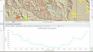
How to create a 2D transect profile in ArcGIS Pro 3.5
How to run Observer Points tool in ArcGIS Pro 3.5
How to use extract values to point tool in ArcGIS Pro 3.5
How to add two rasters using raster calculator for LULC change analysis using ArcGIS Pro 3.5
How to run the Reclassify tool in ArcGIS Pro 3.5
GEO 309: HW 2 - How to plot raster layer, do raster math, and plot histogram
GEO 309: HW2 - How to add raster data using Rasterio
GEO 309: HW2 - How to create folium interactive map with a marker
GEO 302: HW2 - How to create a subset in geopandas
GEO 309: HW 2 - How to create proportional circles
GEO 309: HW 2 - calculate population change between 1950 and 2035
GEO 309: HW 2 - About data
GEO 309: Homework 2 - Data visualization continued
How to run Inverse Distance Weighted (IDW) in ArcGIS Pro 3.5
How to use a dissolve tool to aggregate data for point location in ArcGIS Pro 3.5
How to create a thematic map series in ArcGIS Pro 3.5
How to select data range in attribute table using boolean connectors in ArcGIS Pro 3.5
How to use calculate field tool with numbers stored as text in ArcGIS Pro 3.5
How to perform multiple join tables in ArcGIS Pro 3.5
How to delete field and rows in ArcGIS Pro 3.5
How to use 'Select by Location' in ArcGIS Pro 3.5
How to download tabular data from US census website for spatial analysis
How to digitize a road layer in ArcGIS Pro 3.5
Adding insets (multiple frames) in map layout in ArcGIS Pro 3.5
Adding data from ArcGIS Online and Living Atlas
Using Batch Project Tool in ArcGIS Pro 3.5