Measures of dispersion such as variance and standard deviation are global metrics to describe how much a dataset varies. In this case, it describes how much it varies from the mean. Using ArcGIS Pro and Excel, we look at ways to express, graph and calculate the metrics. We also highlight examples of data which have the same measures of central tendency, but very different standard deviations and variances.
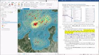
We also looked a ways to calculate the z-score. The z-score is a local metric (calculated for each row or enumeration unit) to measures how far that value is from the mean: (value - average) / standard deviation. In our GIS work, the z-score works best with normalized data when comparing metrics that have different units ($ per year, age in years, percent, etc.) since we can't add these units together and have them make sense. In this tutorial, we also create a new column and calculate the z-score in Excel. This can also be done using adding and calculating new columns in ArcGIS Pro.
These videos have been created in support of teaching and research in the field of GIS (Geographic Information Systems) for the Department of Environmental, Earth and Geospatial Sciences at North Carolina Central University (NCCU). Established in 1910, NCCU is located in Durham, North Carolina, and serves about 8,500 students. The mission of our department is to promote intellectual, professional, and personal excellence through the highest quality instruction, research, and service in the environmental, earth and geospatial sciences. Its vision is to be recognized as a regional, statewide, and national resource for students and society as well as professionals who work in the many fields that are encompassed by the environmental, earth, and geospatial sciences. Students in our programs currently focus their studies in the fields of seismology, natural hazards, GIS (Geographic Information Systems) and Remote Sensing applications, environmental health & impacts and remediation technology among others. Our courses are designed to provide students with the analytical and methodological skills necessary to understand or derive explanations for individual occurrences, for recurring processes, and for invariable as well as statistical regularities in the earth’s lithosphere, hydrosphere, atmosphere, and biosphere. The department prides itself in former students who fostered these skills and have gone onto successful careers in the field at places such as the North Carolina Department of Transportation, City of Durham, Environmental Protection Agency, Lowe’s Corporation, Environmental Protection Agency, National Forest Service, Army Corps of Engineers, real estate firms and private contractors or students who have gone onto Ph.D. programs at places such as North Carolina State University, North Carolina A&T State University and the University of North Carolina, Greensboro.


Информация по комментариям в разработке