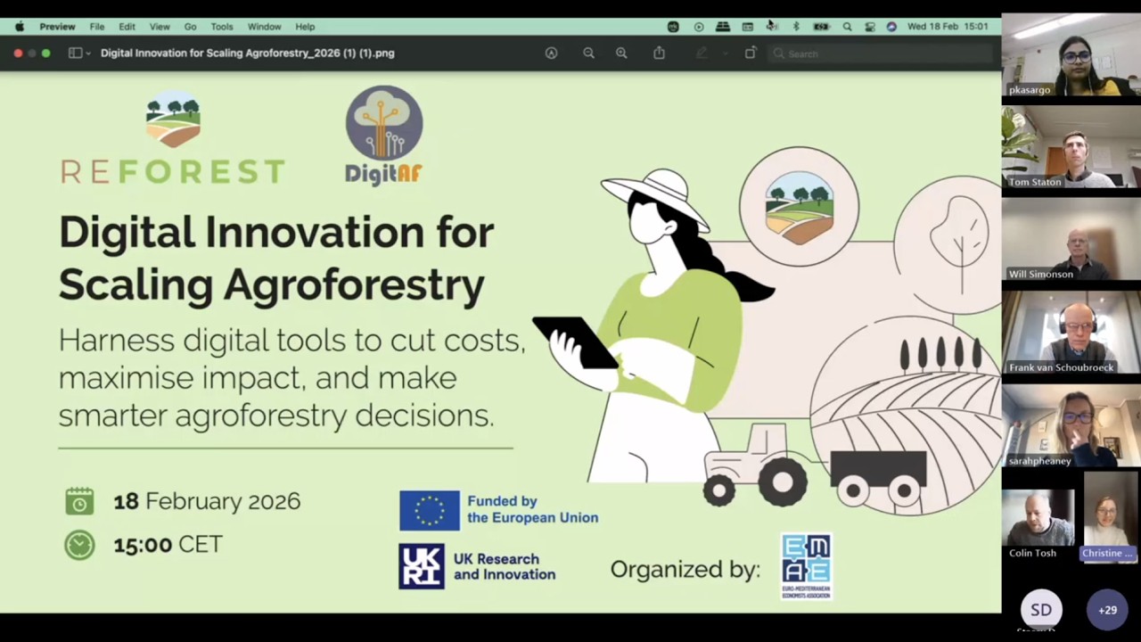
Welcome to the recording of the ReForest webinar held on February 18, 2026, titled “Digital Innovation for Scaling Agroforestry.”
This session brought together researchers, tool developers, advisors, and practitioners to explore how digital solutions can strengthen agroforestry decision-making across Europe.
Will Simonson (Organic Research Centre) opened the session with an overview of the ReForest Toolbox, the DigitAF Tool Catalogue, and the Agroforestry Map of Europe — three complementary knowledge repositories designed to make agroforestry tools, case studies, and spatial data more accessible and actionable.
Dr. Prajna Kasargodu Anebagilu (University of Bonn) presented the Dynamic Management Impact Tool, a decision-analysis based model that evaluates long-term economic performance of agroforestry systems under uncertainty. The tool allows users to compare design options, assess risks, and test the influence of financial support schemes at farm level.
Frank Van Schoubroeck (FarmTree) demonstrated how 30-year simulations can generate projections for yields, income, labour, and carbon sequestration. His presentation showed how scenario modelling can help farmers, consultants, and investors assess the long-term viability of agroforestry systems.
Colin Tosh (Organic Research Centre) introduced the Carbon & Biodiversity Prediction Tool, which uses satellite imagery and spatial modelling to estimate soil carbon and plant biodiversity across Europe. He presented results from farm-level mapping exercises and explained how remote sensing can support environmental performance assessment.
Tom Staton (University of Reading) showcased the ReForest version of the Public Goods Tool — a whole-farm sustainability assessment framework covering soil management, energy use, governance, biodiversity, and business resilience. The tool provides a structured way to evaluate agroforestry systems within broader farm sustainability performance.
Finally, Kristoffer Rønn-Andersen (Regen Farmer) demonstrated RegenWorks, a GIS-based agroforestry design platform that enables users to map fields, design planting layouts, generate tree counts, and export GPS-ready implementation plans.
The webinar concluded with an interactive discussion on data availability, tool complementarity, practical application, and future collaboration opportunities including hands-on workshops planned in connection with the European agroforestry community.
🔗 Learn More and Explore:
Visit our website for event materials and news:
https://agroreforest.eu/news
Access key project outputs and digital tools:
https://agroreforest.eu/tools
Join the ReForest community platform:
https://reforest.euromed-economists.org/
Subscribe to our channel for more updates on agroforestry innovation, Horizon Europe research, and digital tools for sustainable farming.
#Agroforestry #ReForestProject #DigitalInnovation #DecisionSupport #SustainableFarming #NatureBasedSolutions #HorizonEurope #ClimateAction #AgTech #CarbonSequestration #FarmSustainability #Webinar


Информация по комментариям в разработке