Sandy Row is a large inner city estate in south Belfast, Northern Ireland. It lends its name to the surrounding residential community, which is predominantly Protestant working-class. The Sandy Row area had a population of 2,153 in 2001; in 2018, the population was estimated to be around 4,000. It is a staunchly loyalist area of Belfast, being a traditional heartland for affiliation with the paramilitary Ulster Defence Association (UDA) and the Orange Order.
Sandy Row is in south Belfast, beginning at the edge of the city centre, close to the Europa Hotel. The road runs south from the Boyne Bridge over the old Dublin railway line beside Great Victoria Street station, then crosses Donegall Road and ends at the bottom of Lisburn Road. At the north end of the road was Murray's tobacco factory, opened in 1810, while at the other is a large Orange hall.
Formerly known as Carr's Row, Sandy Row is one of the oldest residential areas of Belfast. Its growth in population was in large part due to the expansion of the linen industry in Rowland Street. The name Sandy Row derived from the sandbank which abutted the road that followed the high-water mark resulting from the flow off the tidal waters of the Lagan River estuary. For over two thousand years, the road along the sandbank was the principal thoroughfare leading south from Carrickfergus.
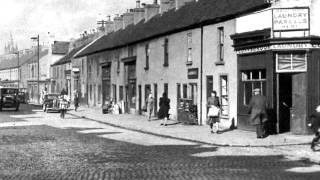
In the 19th century Sandy Row became a bustling shopping district, and by the turn of the 20th-century, there were a total of 127 shops and merchants based in the road. It continued to draw shoppers from all over Belfast until the outbreak of the Troubles in the late 1960s. The rows of 19th-century terraced houses in the streets and backstreets branching off Sandy Row have been demolished and replaced with modern housing. Six of the houses which formerly lined Rowland Street have been rebuilt in the Ulster Folk and Transport Museum.
It is a traditionally Protestant, close-knit loyalist community, noted for its elaborate Orange Order parades on the Twelfth, with over 40 Arches erected in its streets and a marching band of teenaged girls known as the "Sandy Row Girl's Band". In addition to the arches spanning the road, buildings and homes are decorated with flags, bunting and banners. The first Orange Arch was erected by Frank Reynolds in about 1921. In 1690, on his way south to fight at the Battle of the Boyne, King William III of England and his troops travelled along Sandy Row. Tradition holds that part of his army camped on the ground where the Orange Hall now stands. The Hall was opened in June 1910 by Lady Henderson, wife of former Lord Mayor of Belfast, James Henderson. By 1908, there were 34 Orange Lodges in the district.[9] In the 19th and 20th-centuries, there was much sectarian fighting and rioting between Sandy Row Protestants and Catholics from Pound Loney, in the Lower Falls Road.
In the spring 1941 Belfast Blitz during the calamitous 15/16 April raid, the Luftwaffe dropped a parachute landmine at the top of Blythe Street, killing and fatally injuring over ten people including children. Terraced houses on both sides of the street were badly damaged, many with their facades blasted off. The Duke and Duchess of Gloucester paid a visit to the devastated street.
The Sandy Row redevelopment association which was founded in 1970, was one of the first loyalist community groups to open an advice centre. In 1996, the Sandy Row Community Forum was established. It acts as an umbrella organisation for all the community groups in the area.

![[4K] Looking Around The Shankill Road In Belfast](https://i.ytimg.com/vi/k3p8bka7_2A/mqdefault.jpg)

![[4K] A Walk Up Fort William High Street](https://i.ytimg.com/vi/a6yDqWjRWOk/mqdefault.jpg)


Информация по комментариям в разработке