http://www.facebook.com/album.php?aid... - public album
This rugged trail is the premier hike of the Wai'anae Range and one of the oldest trails on the island. This trail is one out of two trails, the other being Wai'anae Ka'ala Trail, that reaches for Mount Ka'ala, the tallest mountain on Oahu.
The Dupont Trail may have been part of an early Hawaiian route from Wai'anae Valley to Waialua. The first recorded use, however, occured in 1920 during a descent of Ka'ala. The explorers named the rediscovered route De Ponte, in honor of an acquaintance, Mary De Ponte. Over the years the name changed to Dupont.
CAUTION: If you plan on hiking the Dupont Trail, regardless if it's a one way trek from Wai'anae - Ka'ala or starting from Waialua, PLEASE call the ranch owner 48 hours (to move their cattle away from the trail as it is part of the grazing area) before your planned hike and request for permission to cross their property. They are very friendly and outgoing and they will most likely say yes, however back in July of 2009, the owner has gotten upset with the increase of trespassing hikers lately and has threatened to cut off access completely, phone call or not. Please, please, please, help us minimize the risk of losing access to such a classic trail by requesting for permission! They are truly gracious people!
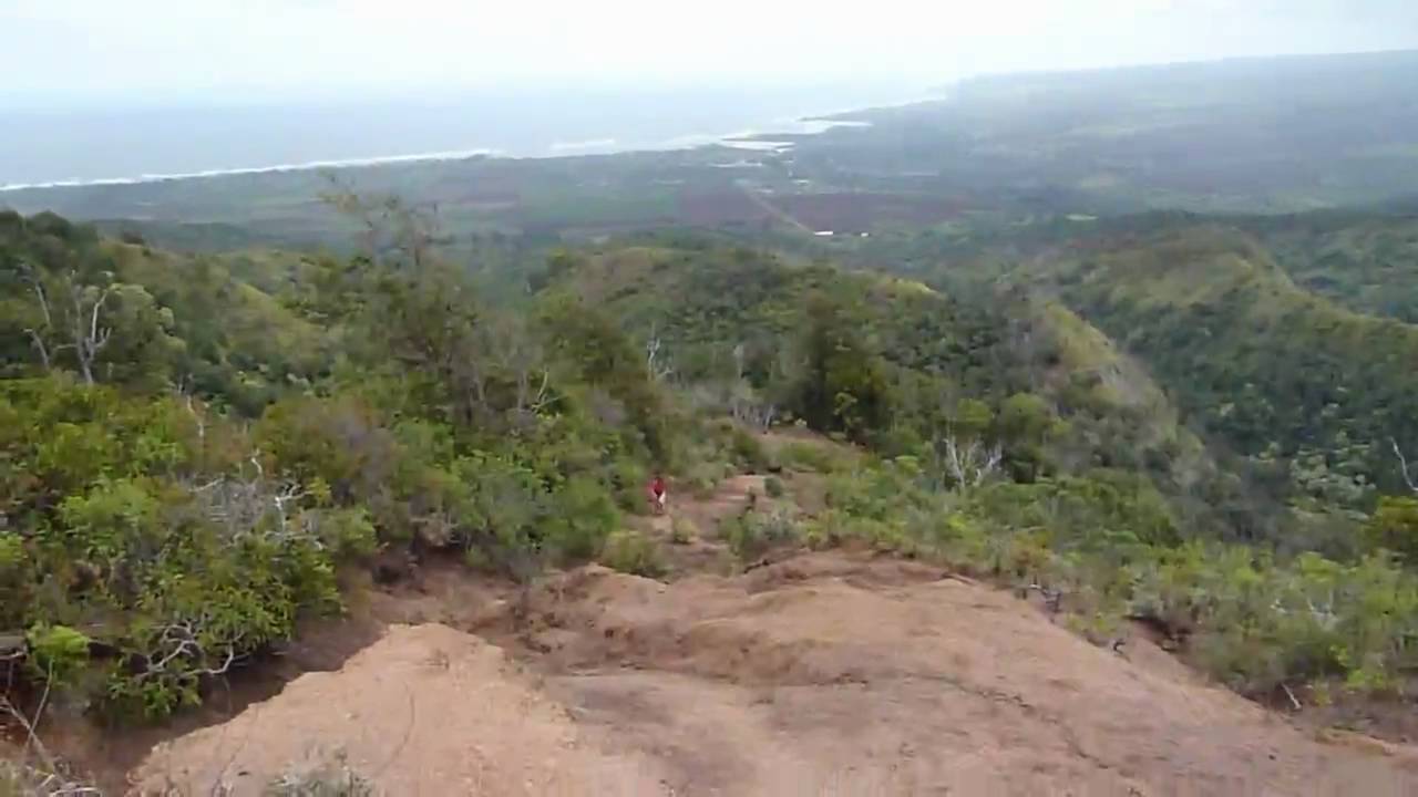
Expect anywhere between 8 to 12 hours of hiking. This trail climbs 4,000ft in 5.5 miles! The beginning portion of the hike is a gradual incline through pastures and forest. Then the trail takes a sudden dip into a saddle and begins it's climb to the ridgeline that will traverse all the way to the summit of Mount Ka'ala. When at the saddle, look up on the ridgeline for a single Ironwood Tree. This is a good spot to rest because serious scrambling resumes afterward through narrow ridgelines with serious dropoffs to one or both sides. At some point, you will come upon a 30ft rockface that must be descended (climbed on the return leg). Beyond that for just about the remainder of the hike is nothing but rope, after rope, after rope. I guesstimate around 15 or 20 ropes on a slippery and often muddy footpath.
After the last rope, the muddy trail finally levels off somewhat and you come upon "the bus stop", an old shack resembling a bus stop and two derelict radar towers. Sorry, don't think there will be any busses here. Continuing on, the trail narrows with cables on both sides, acting as handrails. Further up, just about 100ft shy of the summit, the trail becomes concrete steps, somewhat resembling "Stairway to Heaven", steps with a world class vista!
Just after the stairs, cross a green bridge and reach Mt. Ka'ala Rd. After a short walk, reach the FAA station dead ahead and a helipad off to your right, which leads into the mountain bog, which is actually part of the Wai'anae - Ka'ala Trail. If you feel up to it, you can traverse Ka'ala by combining the Dupont and Wai'anae - Ka'ala Trails as a one way trek from Waialua to Wai'anae. Make sure to park cars on both sides though! it's quite a drive!
WARNING: DO NOT ENTER FAA STATION AS IT IS OFF LIMITS AND GUARDED!
Instead, turn left just before the main gate and contour around the perimeter fence. After going through two small gates, reach the true summit of Ka'ala, marked with a benchmark (4,025ft) and with a grand view of the North Shore from Hale'iwa, across the Wahiawa plains, all the way as far as Diamond Head, and everything in between!
Congratulations! Give yourself a pat on the back. You have conquered the trail with the largest elevation change. What's your reward? The hike back down! Tee hee hee hee!

Информация по комментариям в разработке