👉 SLIPSTREAMO - Book Cheap Flights & Hotels By Visiting https://slipstreamo.com
#columbusohio #columbusoh #cityskylines
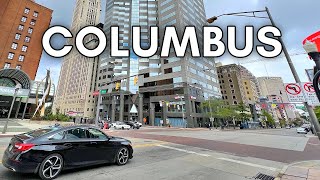
The drive begins on I-70 East, to I-670 East, to I-71 North. Enjoy the ride!
COLUMBUS, OHIO
Numerous medical systems operate in Columbus and Central Ohio. These include OhioHealth, which has three hospitals in the city proper: Grant Medical Center, Riverside Methodist Hospital, and Doctors Hospital; Mount Carmel Health System, which has one hospital among other facilities; the Ohio State University Wexner Medical Center, which has a primary hospital complex and an east campus in Columbus; and Nationwide Children's Hospital, which is an independently operated hospital for pediatric health care. Hospitals in Central Ohio are ranked favorably by the U.S. News & World Report, where numerous hospitals are ranked as among the best in particular fields in the United States. Nationwide Children's is regarded as among the top 10 children's hospitals in the country, according to the report.
Numerous utility companies operate in Central Ohio. Within Columbus, power is sourced from Columbus Southern Power, an American Electric Power subsidiary. Natural gas is provided by Columbia Gas of Ohio, while water is sourced from the City of Columbus Division of Water.
The city's two main corridors since its founding are Broad and High Streets. They both traverse beyond the extent of the city; High Street is the longest in Columbus, running 13.5 mi (21.7 km) (23.4 across the county), while Broad Street is longer across the county, at 25.1 mi (40.4 km).
The city's street plan originates downtown and extends into the old-growth neighborhoods, following a grid pattern with the intersection of High Street (running north–south) and Broad Street (running east–west) at its center. North–south streets run 12 degrees west of due north, parallel to High Street; the avenues (vis. Fifth Avenue, Sixth Avenue, Seventh Avenue, and so on) run 12 degrees off from east–west.
The address system begins its numbering at the intersection of Broad and High, with numbers increasing in magnitude with distance from Broad or High, as well as cardinal directions used alongside street names. Numbered avenues begin with First Avenue, about 1+1⁄4 mi (2.0 km) north of Broad Street, and increase in number as one progresses northward. Numbered streets begin with Second Street, which is two blocks west of High Street, and Third Street, which is a block east of High Street, then progress eastward from there. Even-numbered addresses are on the north and east sides of streets, putting odd addresses on the south and west sides of streets. A difference of 700 house numbers means a distance of about 1 mi (1.6 km) (along the same street).
Other major, local roads in Columbus include Main Street, Morse Road, Dublin-Granville Road (SR-161), Cleveland Avenue/Westerville Road (SR-3), Olentangy River Road, Riverside Drive, Sunbury Road, Fifth Avenue and Livingston Avenue.
Highways
I-71, part of the innerbelt around downtown, bridged by numerous overpasses
Columbus is bisected by two major Interstate Highways: Interstate 70 running east–west and Interstate 71 running north to roughly southwest. They combine downtown for about 1.5 mi (2.4 km) in an area locally known as "The Split", which is a major traffic congestion point, especially during rush hour. U.S. Route 40, originally known as the National Road, runs east–west through Columbus, comprising Main Street to the east of downtown and Broad Street to the west. U.S. Route 23 runs roughly north–south, while U.S. Route 33 runs northwest-to-southeast. The Interstate 270 Outerbelt encircles most of the city, while the newly redesigned Innerbelt consists of the Interstate 670 spur on the north side (which continues to the east past the Airport and to the west where it merges with I-70), State Route 315 on the west side, the I-70/71 split on the south side and I-71 on the east. Due to its central location within Ohio and abundance of outbound roadways, nearly all of the state's destinations are within a two- or three-hour drive of Columbus.
https://en.wikipedia.org/wiki/Columbu... Affiliate Disclosure: This YouTube channel advertises Slipstreamo.com. Slipstreamo.com uses affiliate links for it’s travel search and travel pricing info. Assume all links are affiliate links. Slipstream Motion Pictures Ltd. is paid commission on sales through the affiliate links. Slipstream Motion Pictures Ltd. owns Slipstreamo.com.


Информация по комментариям в разработке