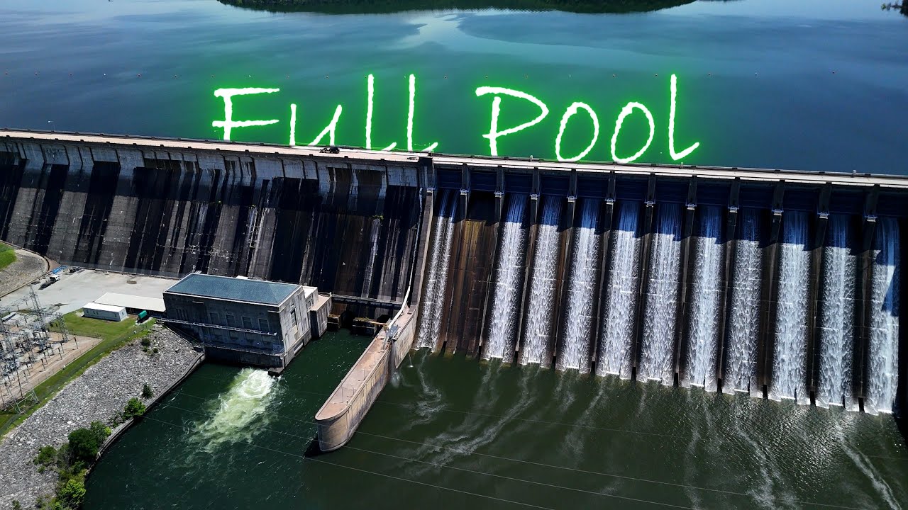
Concrete gravity dam: 2,624 ft long, 590 ft high at the crest, spanning ~222 ft above the stream bed.
Contains 12 spillway gates and four steel-lined 18-ft penstocks feeding two 40 MW turbines.
Required ~1.5 million cubic yards of concrete and ~2,000 tons of reinforcing steel.
Purposes
Flood control for the White River basin—reducing flood peaks by ~3.3 ft on average through the 1940s.
en.wikipedia.org
Hydroelectric power—two generators operational by 1950.
Recreation—creates Norfork Lake (22,000 acres, 550+ mi shoreline)
🌊 Norfork Lake & Recreation
Recreational Crown Jewel: Covers ~22,000 acres with over 540 miles of largely undeveloped shoreline, ideal for boating, water skiing, camping, hiking, and scuba diving.
Diving: Over 30 marked dive sites, depths from 20 to 70 ft, and wall dives down to 150 ft. Visibility peaks (40–60 ft) in spring.
Parks & Trails: 17 Corps-maintained parks like Bidwell Point and Cranfield, plus the Robinson Point and Trans‑Ozark trails.
🎣 Fishing & Fisheries
Lake Fishery: Abundant bass, walleye, crappie, catfish, bream, red‑ear sunfish, and prize striped bass—stripers over 30 lbs common.
Tailwater Trout Fishery: Cold outflows from the dam created world-class trout waters below. Brown, rainbow, brook, and cutthroat trout thrive, with AGFC oversight and stocking from the Norfork National Fish Hatchery (founded 1957; produces ~500,000 lbs of trout annually).
Youth/disabled fishing: Dry Run Creek offers catch-and-release trout fishing, designed for youth and disabled anglers.
📈 Local Impact & History
Economic Revival: During the Depression, Baxter County's economy struggled. The dam's construction provided ~815 jobs on average and stimulated Mountain Home’s growth, paving and electrifying roads.
Regional Development: The dam’s creation triggered tourism and boosted commerce by transforming Mountain Home into a hub between Norfork and Bull Shoals lakes.
🚨 Management & Safety
The Corps operates the dam under a Master and Shoreline Management Plan to balance recreation, ecological health, and public access.
In May 2025, all 12 spillway gates opened due to heavy rainfall, releasing ~6,600 cfs through spillways and ~12,000 cfs overall—near flood-pool elevation of 580 ft.
581.01 ft (April 11, 2008) – verified by the U.S. Army Corps of Engineers
Safety drills are regularly carried out with state and local agencies to prepare for flood events.
In Summary
Norfork Dam is a remarkable multi-purpose structure: a flood-control marvel, a power producer, and the creator of one of Arkansas’s most scenic and recreationally rich lakes. Whether you're into diving, trout fishing, or lakeside camping, Norfork offers something for everyone, with a history that transformed the region’s economy and landscape.
#NorforkLake #LakeLevels #ArkansasLakes #HighWater #FloodWatch #2025Update #BoatingSeason #FishingArkansas #LakeLife #OutdoorAdventures #BassFishing #TroutFishing #WaterLevelUpdate #USArmyCorps #FloodControl #WeatherWatch #DamSafety

Информация по комментариям в разработке