hello hello my friends. this is a map of the beautiful U.S. virgin islands. The U.S. Virgin Islands are in the Atlantic Ocean, about 40 miles east of Puerto Rico and immediately west of the British Virgin Islands. They share the Virgin Islands archipelago with the Puerto Rican Virgin Islands of Vieques and Culebra , and the British Virgin Islands.
The territory consists of three main islands: St. Thomas, St. John, and St. Croix, as well as several dozen smaller islands. The main islands have nicknames often used by locals: "Twin City" (St. Croix), "Rock City" (St. Thomas), and "Love City" (St. John). The combined land area of the islands is roughly twice the size of Washington, D.C.
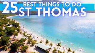
The U.S. Virgin Islands are known for their white sand beaches, including Magens Bay and Trunk Bay, and deepwater harbors along the Anegada Passage, including Charlotte Amalie (the capital) and Christiansted. Like most Caribbean islands, most of the islands of the Virgin Islands, including St. Thomas and St. John, are volcanic in origin and hilly. The highest point is Crown Mountain on St. Thomas at 1,555 feet.
st. Croix, the largest of the U.S. Virgin Islands, lies to the south and has a flatter terrain because of its coral origin. The National Park Service manages more than half of St. John, nearly all of Hassel Island, and many acres of coral reef.
There are several national park sites, such as the Virgin Islands National Park, Virgin Islands Coral Reef National Monument, Buck Island Reef National Monument, Christiansted National Historic Site, and Salt River Bay National Historical Park and Ecological Preserve.
The U.S. Virgin Islands lie on the boundary of the North American plate and the Caribbean Plate. Natural hazards include earthquakes, hurricanes and tsunamis.
The U.S. Virgin Islands contain the Leeward Islands moist forests and Leeward Islands xeric scrub terrestrial ecoregions. thanks for listening. please subscribe for the best maps and for the love of the u.s. virgin islands. The United States Virgin Islands, officially the Virgin Islands of the United States, are a group of Caribbean islands and an unincorporated and organized territory of the United States. The islands are geographically part of the Virgin Islands archipelago and are located in the Leeward Islands of the Lesser Antilles to the east of Puerto Rico and west of the British Virgin Islands.
The U.S. Virgin Islands consist of the main islands of Saint Croix, Saint John, and Saint Thomas and 50 other surrounding minor islands and cays. The total land area of the territory is 133.73 square miles (346.36 km2). The territory's capital is Charlotte Amalie on the island of St. Thomas.
Previously known as the Danish West Indies of the Kingdom of Denmark–Norway (from 1754 to 1814) and the independent Kingdom of Denmark (from 1814 to 1917), they were sold to the United States by Denmark for $25,000,000 in the 1917 Treaty of the Danish West Indies and have since been an organized, unincorporated United States territory. The U.S. Virgin Islands are organized under the 1954 Revised Organic Act of the Virgin Islands and have since held five constitutional conventions.
Tourism and related categories are the primary economic activities, Districts and subdistricts of the U.S. Virgin Islands
Districts St. Thomas St. John St. Croix
Sub-districts
Charlotte Amalie
East End
Northside
Southside
Tutu
Water Island
West End
Central
Coral Bay
Cruz Bay
East End
Anna's Hope Village
Christiansted
East End
Frederiksted
Northcentral
Northwest
Sion Farm
Southcentral
Southwest
Each of the three main islands of the U.S. Virgin Islands is counted as a county equivalent by the U.S. Census Bureau, with the following FIPS codes: 78010 for St. Croix, 78020 for St. John, and 78030 for St. Thomas.
While a Danish possession, the islands were divided into "quarters" (five on St. John and nine on St. Croix), which were further divided into many dozens of "estates". Estate names are still used to write addresses; estates and quarters are used in describing real estate, especially on St. John and St. Croix. More densely populated towns such as Frederiksted and Christiansted on St. Croix were historically referred to as "districts", in contrast to the surrounding plantation land.
Self-determination
A 1993 referendum on status attracted only 31.4% turnout, and so its results (in favor of the status quo) were considered void. No further status referenda have been scheduled since.
The territory is classified by the United Nations as a non-self-governing territory. In 2016, the United Nations' Special Committee on Decolonization recommended to the UN's General Assembly that this larger body should "actively pursue a public awareness campaign aimed at assisting the people of the United States Virgin Islands with their inalienable right to self-determination and in gaining a better understanding of the options for self-determination


Информация по комментариям в разработке