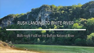
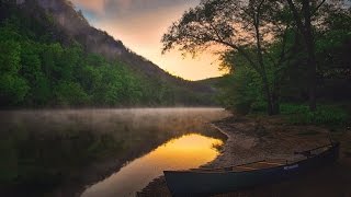
After 3+ years of completely overthinking this float, I finally just went for it....and man had I been missing out!
For more of what to expect on this float, read on. To skip to waypoints & other location info, scroll on down - but please consider SUBSCRIBING if you've found this free information useful. We'd appreciate that, thanks for watching!
First order of business is to sincerely thank Amanda & Creed at Crockett's Canoe Rental. They have helped us float many sections of the Buffalo, some many times over and knew this was a bucket list trip for us. Amanda waved a wand on their schedule for us on the fly, and Creed always gets a kick out of us loading up and pushing off. Please, consider Crockett's for shuttle / rental needs when floating the middle / lower sections of the river!
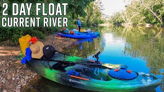
Multi day floats with a dog add additional variables to consider when planning a trip. The obvious: weather, river levels and supplies. Mine are compounded by Leeds' desire to swim when he wants, or get up on the kayak when he wants - which ultimately always leads Leeds to assisting a tip somewhere along the way. For those reasons, and the extra 70lbs of Leeds, I've learned to pack light.
He's an accomplished river swimmer, can easily handle 10+ swimming miles daily. The low water level on this trip negated a need for his float vest although he does wear one in higher water conditions. I'd planned for 3 days / 2 nights for this trip, but knocked it out comfortably in 2 days.
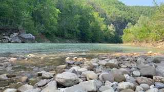
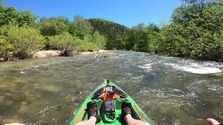
Just a few hundred feet downstream of Rush Landing is Clabber Shoals, a short stretch of notoriety that for us means tip. Sneakily hidden just below the water line are plenty of rocks and boulders that are ripe for bumps...then spills, so we just walked through it. After that, this float is mostly plain sailing.
You'll encounter plenty of long stretches of pools to paddle through, each with a small shoal or chute to navigate at the end of. Another 6-8 inches of water would have been ideal to avoid the dozen or so times that I had to drag, although none were particularly lengthy.
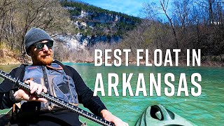
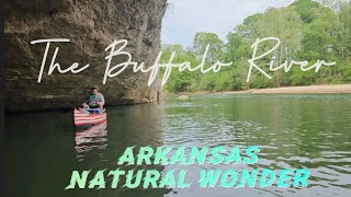
Of the many miles we've now travelled along the Buffalo, this stretch has already become my favorite. Once you're in, you're in - and for that reason you're unlikely to see many (if any) other floaters at all. Like most stretches of the river, you'll also encounter plenty of towering bluffs to gawk at as you soak the scenery. None more so than Elephant Head Rock - a spot you'll see for a good half mile as you approach it.
The NPS officially lists the distance from Rush to Buffalo City on the White River as 24.2 miles. My GPS displayed 30 miles in total, in part due to some river bank exploring but also due to our take out at the Cartney access point on the White River, 3 miles downstream of the Buffalo/White confluence.
You might not know until you get there, but if Bull Shoals Dam is releasing, then accessing Buffalo City means crossing the White River in perhaps fairly fast water and then paddling upstream a short way against the current. That's not a wise ask of Leeds at the back end of a lengthy float, so Cartney it is.
It's an easy 3 miles - even though the dam wasn't releasing there was still plenty of current to just carry us along without any paddling. Besides, the noticeably cooler water is amazingly clear. Marvel at the schools of fish swimming around you or at the bluffs at Cartney - either way, it's just as scenic!
Float the NEARBY Grinders Ferry to South Maumee: • Видео
OTHER RESOURCE LINKS FOR THIS FLOAT:
Crockett's Canoe Rental: https://www.buffalorivercanoerental.com/
Buffalo River NPS: https://www.nps.gov/thingstodo/paddli...
Map of 50+ Easy Access / Kid Friendly Falls in AR (Google map link in description section) • Short hikes, easy access and KID FRIE...
Map of 600+ Waterfalls in AR (Google map link in description section) • HUGE Updated Waterfalls in Arkansas 2...
FOLLOW US:
Facebook: / fallsinar
Insta: / waterfallsinar
TikTok: / gezrogers
AllTrails: https://www.alltrails.com/members/gez...
CELL SIGNAL (AT&T): Not much to absolutely NONE for miles. Download what you need BEFORE you go!
STATS:
Date: 7/25 - 7/26/2023
Distance: 29.8 miles
River Levels: 158 cfs / 2.89' at HWY 14 gauge.
VIEW OR DOWNLOAD:
My GAIA track: https://www.gaiagps.com/datasummary/t...
OVERALL FLOAT DIFFICULTY: Easy at these water levels.
WAYPOINTS:
Rush Landing: 36.12422, -92.54882
Cartney Access Point: 36.19164, -92.38113
We respect "Leave no Trace" principles, please do likewise. We adventure often, and Leeds is very well trained (and patient with me) with regard to swims, climbs and scrambles. Know the limits of your dog, and your ability to handle it if you elect to take it.
#arkansas #buffaloriver #lowerbuffalowilderness #float #kayak #crockettscanoerental #nps #buffalorivernationalpark


Информация по комментариям в разработке