MCC ESI Connectivity Project
In November 2006, the Millennium Challenge Corporation (MCC) and the Government of El Salvador (GoES) signed a five-year, $461 million compact, known as El Salvador Compact (ESI), to reduce poverty by investing in the underdeveloped Northern Zone of the country. The compact invested in education, public services, agricultural production, rural business development, and transportation infrastructure.
The transport part of this project was called the Connectivity Project and consisted of a substantial upgrade of the Northern Transnational Highway (NTH). This compact was enacted in 2007, and then closed in 2012. The objective of the Connectivity Project was to “Reduce travel cost and time within the Northern Zone, with the rest of country, and within the region”. A total of 223.32 km of roads were delivered as part of ESI.
MCC engaged CH2M to conduct an independent evaluation for transportation and border infrastructure improvements delivered as part of the ESI Connectivity Project in El Salvador, with support expertise from Transport Research Laboratory (TRL), and Social Impact (SI), who together form the Evaluation Team (ET). This evaluation includes a full evaluation of ESI using the Highway Development and Management software tool (HDM-4) for an economic evaluation, led by TRL. The evaluation relies on a wide range of data collection activities, including field data collection. This will include road condition and International Roughness Index (IRI) surveys, as well as classified traffic count surveys and Origin-Destination (O-D) surveys.
TRL is responsible for the road condition and IRI surveys. These were planned using Class 1 profilometer equipment, but due to the COVID-19 pandemic, this was not possible because equipment and staff would need to be transported to El Salvador. The ET proposed an alternative methodology for carrying out these surveys, using local staff and equipment, with some small items being shipped to El Salvador. The revised surveys will include:
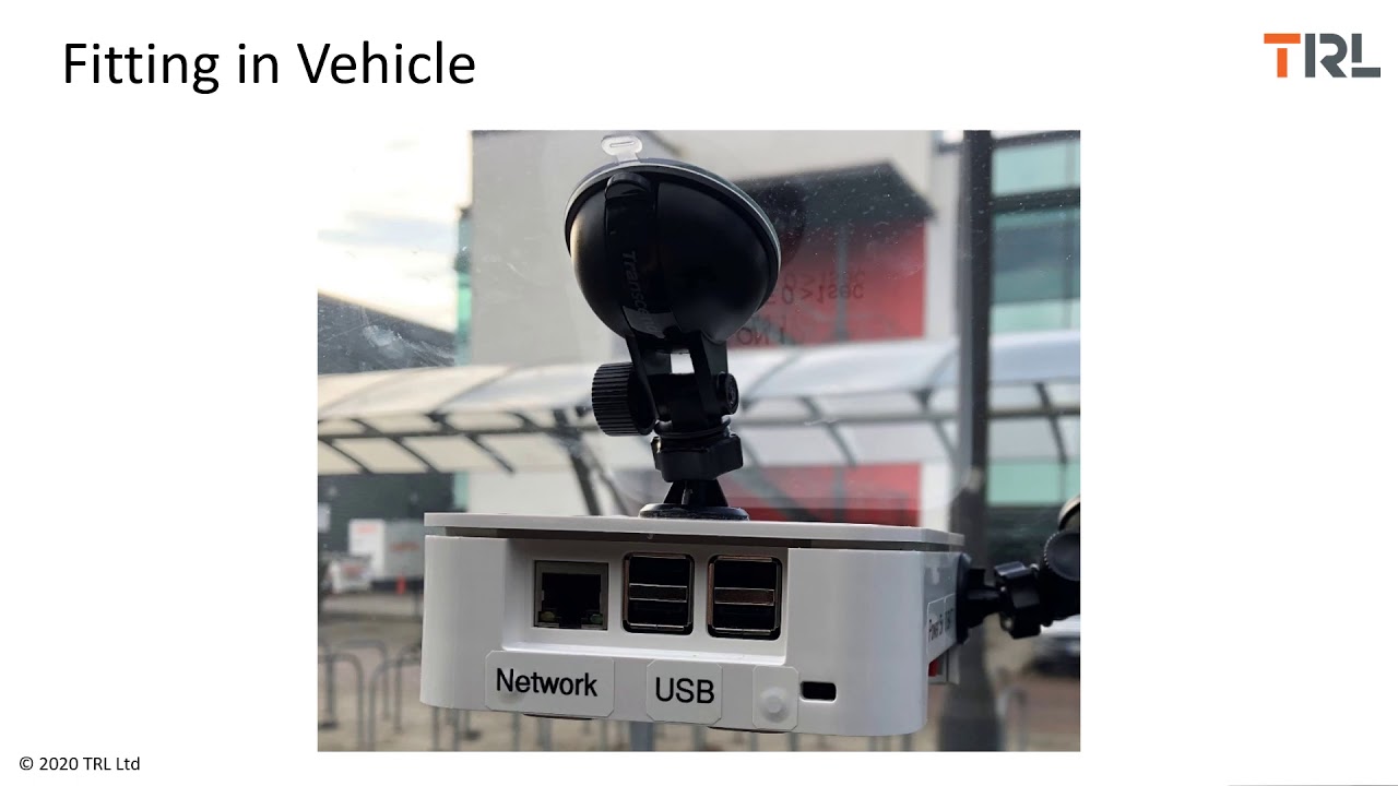
• IRI measurement using a TRL low cost data collection prototype, based on a Raspberry Pi with camera. IRI will also be independently measured using tow different Smartphone Apps, RoadLab Pro and Roadroid.
• The TRL prototype will also take high resolution still images of the road, and record GPS tracks. This can be used to extract visual condition, such as cracking, ravelling, potholing and patching.
• High-resolution video will also be collected using a proprietary DashCam. This will record ultra-HD video of the NTH, with speed, GPS location, and accelerometer data. This will again be used to identify surface defects and locations that may need further investigation, such as off-road drainage.
Training materials have been developed for the local survey team, who will undertake the surveys. These training materials include a video on how to install the various equipment in a survey vehicle, and a video on how to install and operate the TRL prototype. The DashCam and Smartphone Apps have video and operation instructions available online.

Информация по комментариям в разработке