A drive out to Anglesey, taking in Benllech & Red wharf Bay.
The Isle of Anglesey (/ˈæŋɡəlsiː/; Welsh: Ynys Môn [ˈənɨs ˈmoːn]) is a county off the north-west coast of Wales. It is named after the island of Anglesey, which makes up 94% of its area, but also includes Holy Island (Ynys Gybi) and some islets and skerries.[2] The county borders Gwynedd across the Menai Strait to the southeast, and is otherwise surrounded by the Irish Sea. Holyhead is the largest town, and the administrative centre is Llangefni. The county is part of the preserved county of Gwynedd.
The Isle of Anglesey is sparsely populated, with an area of 276 square miles (710 km2) and a population of 68,900.[3] After Holyhead (12,103),[4][failed verification] the largest settlements are Llangefni (5,500) and Amlwch (3,967). The economy of the county is mostly based on agriculture, energy, and tourism, the latter especially on the coast. Holyhead is also a major ferry port for Dublin, Ireland.[5] The county has the second-highest percentage of Welsh speakers in Wales, at 57.2%, and is considered a heartland of the language.[6]
The island of Anglesey, at 676 square kilometres (261 sq mi), is the largest in Wales and the Irish Sea, and the seventh largest in Britain. The northern and eastern coasts of the island are rugged, and the southern and western coasts are generally gentler; the interior is gently undulating. In the north of the island is Llyn Alaw, a reservoir with an area of 1.4 square miles (4 km2). Holy Island has a similar landscape, with a rugged north and west coast and beaches to the east and south. The county is surrounded by smaller islands; several, including South Stack and Puffin Island, are home to seabird colonies. Large parts of the county's coastline have been designated an Area of Outstanding Natural Beauty.
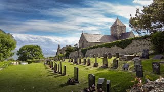
The county has many prehistoric monuments, such as Bryn Celli Ddu burial chamber. In the Middle Ages the area was part of the Kingdom of Gwynedd and native Principality of Wales, and the ruling House of Aberffraw maintained courts (Welsh: llysoedd) at Aberffraw and Rhosyr. After Edward I's conquest of Gwynedd he built the castle at Beaumaris, which forms part of the Castles and Town Walls of King Edward in Gwynedd World Heritage Site. The Menai Strait to the mainland is spanned by the Menai Suspension Bridge, designed by Thomas Telford in 1826, and the Britannia Bridge, originally designed by Robert Stephenson in 1850.
The English name for Anglesey may be derived from the Old Norse; either Ǫngullsey "Hook Island"[7] or Ǫnglisey "Ǫngli's Island".[7][8] No record of such an Ǫngli survives,[9] but the place name was used by Viking raiders as early as the 10th century and later adopted by the Normans during their invasions of Gwynedd.[10] The traditional folk etymology reading the name as the "Island of the Angles (English)"[11][12] may account for its Norman use but has no merit,[8] as the Angles' name itself is probably cognate with the shape of the Angeln peninsula. All of them ultimately derive from the proposed Proto-Indo-European root *ank- ("to flex, bend, angle").[13] Throughout the 18th and 19th centuries and into the 20th, it was usually spelt Anglesea in documents,[14] a spelling that is still occasionally used today.
Ynys Môn, the island's and county's Welsh name, first appeared in the Latin Mona of various Roman sources.[15][16][17] It was likewise known to the Saxons as Monez.[18] The Brittonic original was in the past taken to have meant "Island of the Cow".[11][19] This view is untenable according to modern scientific philology, and the etymology remains a mystery.
Poetic names for the island of Anglesey include the Old Welsh Ynys Dywyll (Shady or Dark Isle) for its former groves and Ynys y Cedairn (Isle of the Brave) for its royal courts;[12] Gerald of Wales' Môn Mam Cymru ("Môn, Mother of Wales") for its agricultural productivity;[20] and Y fêl Ynys (Honey Isle).[21]
The history of the settlement of the local people of Anglesey starts in the Mesolithic period. Anglesey and the UK were uninhabitable until after the previous ice age. It was not until 12,000 years ago that the island of Great Britain became hospitable.[22] The oldest excavated sites on Anglesey include Trwyn Du (Welsh: Black nose) at Aberffraw. The Mesolithic site located at Aberffraw Bay (Porth Terfyn) was buried underneath a Bronze Age 'kerb cairn' which was constructed c. 2,000 BC. The bowl barrow (kerb cairn) covered a material deposited from the early Mesolithic period; the archeological find dates to 7,000 BC.
#wales #northwales #anglesey #beach #sea #vlog #germanshepherd #gsdlovers #gsdpuppy #gsd #familytime #family #daysout #qualitytime #holidays


Информация по комментариям в разработке