June 28, 2019 ESA Sentinel-2 multispectral satellite imagery of Blackhawk and Silver Reef Landslides, Lucerne Valley, San Bernardino Mountains, north of San Andreas Fault, Mojave Desert, California. 3D perspective rendered with QGIS software for the purpose of reexamining stratigraphy and kinematics of the landslide complex. Sentinel-2 bands 2, 3, 4, 8 draped on 3d DEM model. Playlist of my long-run-out landslide videos:
• Blackhawk, Silver Reef Rock Avalanches, Mu...
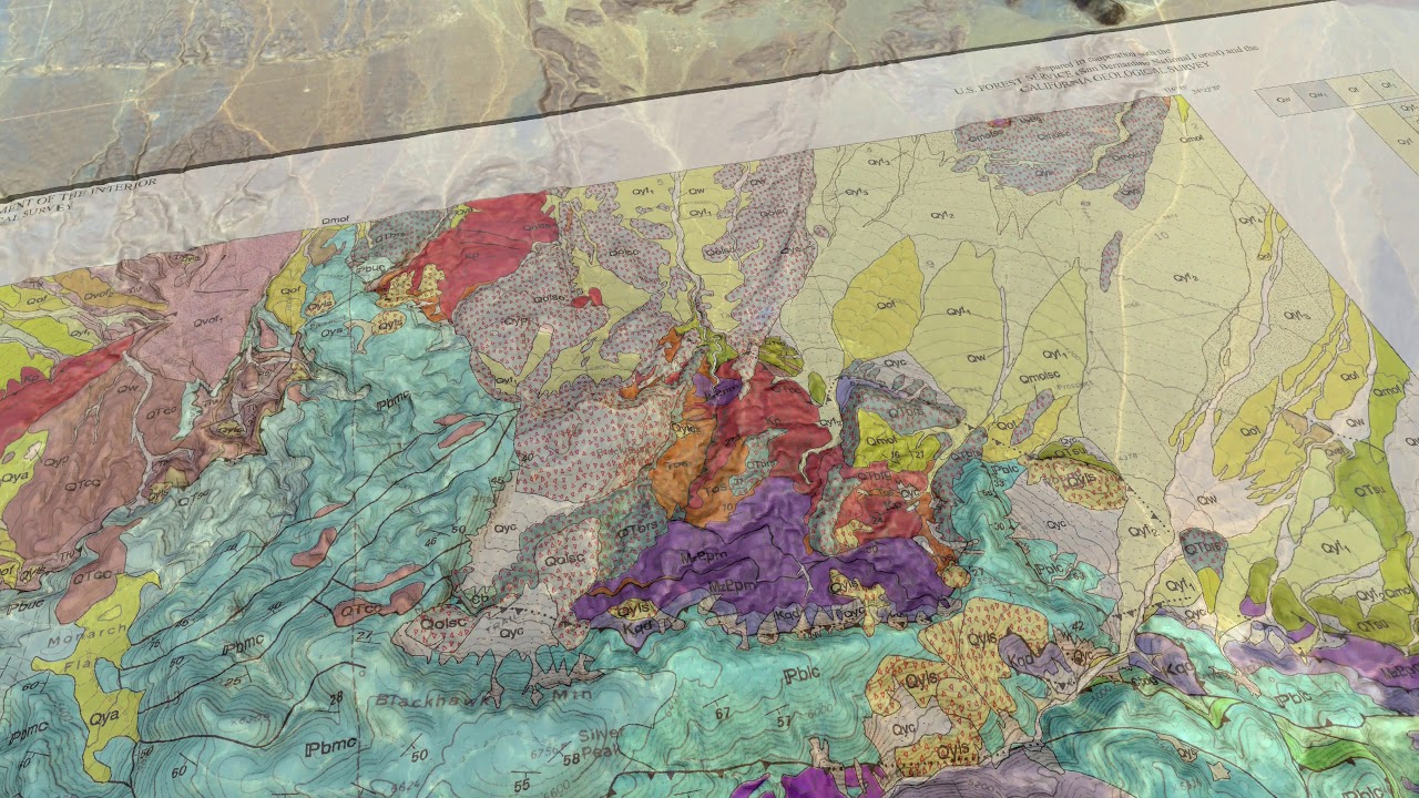
Additional information:
Shreve, Ronald Lee,1959, Geology and mechanics of the Blackhawk landslide, Lucerne Valley, California. Dissertation (Ph.D.), California Institute of Technology. http://resolver.caltech.edu/CaltechET...
Shreve, Ronald L., 1968, The Blackhawk landslide, Special Paper - Geological Society of America, 108, 47 p. https://pubs.geoscienceworld.org/book...
Shreve, Ronald L., 1968, Leakage and Fluidization in Air-Layer Lubricated Avalanches. GSA Bulletin 79 (5): 653-658. https://pubs.geoscienceworld.org/gsa/...
Shreve, R. L. 1987, Blackhawk landslide, southwestern San Bernardino County, California, Centennial Field Guide, Cordilleran Section, 109–114, Geological Society of America, Fresno, Calif. https://pubs.geoscienceworld.org/book...
Dibblee, T.W., 1964, Geologic map of the Lucerne Valley quadrangle, San Bernardino County, California, USGS Miscellaneous Geologic Investigations Map I-426
https://ngmdb.usgs.gov/Prodesc/prodde...
Powell, R.E., and Matti, J.C., 2000, Geologic map and digital database of the Cougar Buttes 7.5' quadrangle, San Bernardino County, California, USGS Open-File Report OF-2000-175
https://ngmdb.usgs.gov/Prodesc/prodde...
https://pubs.usgs.gov/imap/0426/repor...
Miller, F.K., and Cossette, P.M., 2004, Preliminary geologic map of the Big Bear City 7.5' quadrangle, San Bernardino County, California, USGS Open-File Report OF-2004-1193
https://ngmdb.usgs.gov/Prodesc/prodde...
USGS, 1987, Recent reverse faulting in the Transverse Ranges, California, Professional Paper 1339 https://pubs.er.usgs.gov/publication/...
CGS, 1986, Geologic Map San Bernardino Quadrangle
ftp://ftp.consrv.ca.gov/pub/dmg/pubs/rgm/RGM_003A/
USGS DEM data:
https://viewer.nationalmap.gov/basic/...
ESA Copernicus Open Access Hub: https://scihub.copernicus.eu/dhus/#/home
ESA Sentinel Application Program (SNAP) download:
http://step.esa.int/main/download/sna...
QGIS download: https://www.qgis.org/en/site/forusers...

Информация по комментариям в разработке