🌪️ SEVERE WEATHER OUTLOOK – TUESDAY, MARCH 10, 2026 (16:30Z Update)
SPC Risk Level: MODERATE (Level 4 of 5)
Valid through 7 AM CDT Wednesday
📍 Major Cities in Risk Zones
🔴 MODERATE Risk: Joliet, IL, Peoria, IL, Bloomington, IL, Normal, IL, Pekin, IL
🟠 ENHANCED Risk: Chicago, IL, Fort Worth, TX, Fort Wayne, IN, Aurora, IL, Naperville, IL
🟡 SLIGHT Risk: Dallas, TX, Detroit, MI, Indianapolis, IN, Oklahoma City, OK, Kansas City, MO
🟢 MARGINAL Risk: San Antonio, TX, Columbus, OH, Austin, TX, Memphis, TN, Milwaukee, WI
🌪️ Tornado Risk Zones
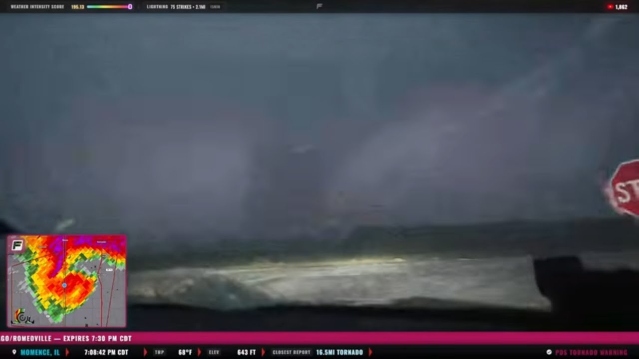
🟡 15% Tornado Risk (Strong Tornado Potential): Northern and central Illinois into northwest Indiana, including Peoria, Bloomington, Joliet, and areas near Chicago
🟤 5% Tornado Risk: Broader corridor from Missouri and southern Illinois into Indiana and portions of the southern Plains including parts of Texas and Oklahoma
🟢 2% Tornado Risk: Surrounding areas from the southern Plains through the Midwest and into the southern Great Lakes
What the Percentages Mean
A 15% tornado risk indicates a significant severe weather setup, where multiple tornadoes are possible within 25 miles of a point, including the potential for strong tornadoes (EF2+).
📝 Overview
A dangerous severe weather setup is unfolding today from the southern Plains into the Midwest and southern Great Lakes.
Across the Midwest, a surface low moving northeast toward Illinois combined with increasing moisture and strengthening wind fields will create an environment favorable for intense supercells late this afternoon and evening.
Surface dewpoints climbing into the low to mid-60s°F, combined with steep lapse rates and strong wind shear, will support very large hail and tornado-producing storms. A strengthening low-level jet this evening will further enhance rotation potential, creating a focused corridor for multiple strong tornadoes across northern and central Illinois into northwest Indiana.
Farther south across Texas and Oklahoma, storms developing along the dryline will likely become supercells capable of very large hail (2–3+ inches) before evolving into clusters that may produce damaging winds and embedded tornadoes through the evening.
⛈️ Hazards Include
🧊 Very large hail (2–3+ inches possible with supercells)
🌪️ Multiple tornadoes possible, including strong EF2+ tornadoes in the Midwest
💨 Damaging wind gusts as storms organize into clusters later tonight
🕓 Timeline
3–6 PM CDT: Initial supercells develop across eastern Nebraska, Kansas, and west Texas
5–9 PM CDT: Peak tornado potential across central and northern Illinois into northwest Indiana
9 PM – 3 AM CDT: Storms grow into clusters moving east across Indiana, Ohio Valley, and southern Great Lakes
📌 Regional Notes
🔴 Northern/Central Illinois → Northwest Indiana: Greatest potential for strong tornadoes and very large hail
🟠 Texas into Southwest Oklahoma: Initial supercells capable of giant hail before storms organize into clusters
🟡 Midwest/OH Valley overnight: Tornado and wind threat may continue with eastward-moving storm complexes
⚠️ Stay Weather-Aware
Residents across Illinois, Indiana, Missouri, and parts of Texas and Oklahoma should closely monitor weather conditions this afternoon and evening. The environment will support rapid storm intensification, and warnings may be issued with little lead time.
———————————
In-Vehicle
Driver, Man-of-Action - @ReedTimmerWx
Navigator, Man-of-Music - @localmanweatherofficial
Engineer, Man-of-Iron - @willclay25
Studio
Guy in the corner - @brianvotoole, but he doesn't really post anything. he's just laying in the cut, you know?
Thanks United Cajun Navy - https://unitedcajunnavy.org/
And Thanks to RED EARTH TECH! - https://www.red-earth.tech/


Информация по комментариям в разработке