#LEIAH #LAYYAH #APNALAYYAH #APNALEIAH #LAYYAHVLOG #LEIAHVLOG #DOCUMENTARYOFLEIAH #LAYYAHDOCUMENTARY
APNA LEIAH | LAYYAH | DOCUMENTARY OF LAYYAH | STREET VIEW AND ROAD MAP OF LAYYAH PUNJAB PAKISTAN
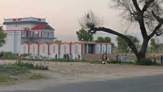
Layyah District (Urdu: ضِلع ليّہ), (Punjabi: ضلع ليہ), is a district in the Punjab, Pakistan. It is located in the southern part of the province. Layyah City is the district headquarter of Layyah District. Layyah has hot desert climate.
It lies between 30–45 to 31–24 deg north latitudes and 70–44 to 71–50 deg east longitudes. The area consists of a semi-rectangular block of sandy land between the Indus River and the Chenab River in Sindh Sagar Doab. The total area covered by the district is 6,291 km2 with a width from east to west of 88 kilometres (55 mi) and a length from north to south of 72 kilometres (45 mi).
The town was founded around 1550 by Kamal Khan, who laid foundation of Dera Ghazi Khan. Around 1610, the town was taken from the Rulers, who held it until 1787. Abdun Nabi Sarai was appointed Governor by Timur Shah Durrani, but three years later it was included in the Governorship of Muhammad Khan Sadozai, who transferred his seat of Government to Mankera. In 1794, Humayun Shah, the rival claimant to the throne of Kabul, was captured near Layyah and brought into the town, where his eyes were put out by order of Zaman Shah. Under the Sikh Government, the town once more became the centre of administration for the neighbouring tract, and after the British occupation in 1849, was for a time the headquarters of a Civil Administrative Division. This administrative status of Layyah was short-lived and the British reduced it to the level of Tehsil headquarters, making it a part of Dera Ismail Khan. In 1901, Layyah was transferred to the new District of Mianwali. Later on, it was made part of the Muzaffargarh District. In 1982, Layyah Tehsil was upgraded to District headquarters comprising three Tehsils: Layyah, Karor and Chaubara. The municipality was created in 1875.[4]
The district of Layyah is made up of three tehsils:[5]
Chaubara Tehsil
Karor Lal Esan Tehsil
Layyah Tehsil
There are three main town of District Layyah[6]
1.Chowk Azam
2.Fatehpur
Education
According to Pakistan District Education Ranking, a report released by Alif Ailaan, Layyah is ranked at number 38 out of 155 districts nationally with an education score of 66.76. The learning score of Layyah is 70.8.[7] The readiness score of Layyah is 65.13 ranking the district at number 31. Furthermore, the school infrastructure score of Layyah is 94.38, placing it a national rank of 18.[7] The score reflects that most schools in Layyah have all basic facilities e.g. electricity, drinking water and functional toilets. The issues reported in TaleemDo! App by the residents of Layyah suggest that students of government schools have low confidence as compared to private schools, but the students can’t go to private schools because of high fees. Complaints about quality of teachers and a few basic facilities are also the issues reported in the app.
Higher Education
In education Layyah is improving day by day.[8]
Public Sector Colleges
There are 20 colleges available for the education of males and females of Layyah.[9]
Department of Business Administration
Department of English
Department of Economics
Department of Psychology
Department of Sociology
Department of Education
Colleges
College of Veterinary Sciences
College of Agriculture
Private Sector Universities
Govt. College University Faisalabad (Layyah Campus)
University of Education, Lahore (Layyah Campus)
Govt. College University, Lahore (Layyah Campus)
National College of Business Administration & Economics Lahore (Layyah Campus)
Small Dams
There are 13 small dams in the district to provide water for irrigation.[11]
Khokher Zer Dam
Surlah Dam
Dhok Talian Dam
Kot Raja Dam
Dhoke Qutab Din Dam
Nikka Dam
Walana Dam
Khai Gurabh Dam
Pira Fatehal Dam
Bhagtal Dam
Dhurnal Dam
Mial Dam
Kanwal Dam
Dhrabi Dam
Khai Dam
Chowkhandi Dam
Minwal Dam
Industries
There are multiple industries in Layyah.[8]
Sugar Mill 01
Rice Factories 15
Cotton Ginning Factories 25
Ice Factories 18
Vegetable Ghee Factory 01
Cold Storage 05
Flour Mills 13
Total 78
Land Statistics
Land of Layyah is categorized in 6 parts.[8]
Rail Network
Rail Network of the district is linked as:
Rail Network also available for Layyah to Muzaffargarh & Multan and Layyah to Bhakkar - Mianwali to Rawalpindi / Islamabad
Floods
Sehar village residents flood-prone Layyah district, had seen their homes repeatedly inundated and they finally took matters into their own hands and rebuilt their homes on raised dirt platforms five to six feet high, shored up with eucalyptus trees planted around the edges.[13][14][15]
Demography
The population, according to the 1998 census was 2 Million. Per capita income during the ten years ending 1902-3 averaged Rs. 9,900, and expenditure Rs. 10,100. In 1903-4, the income was Rs. 10,600, chiefly derived from


Информация по комментариям в разработке