Tons ke us paar: • The Geography of Himachal Pradesh
This video aims to describe the physical geography of the beautiful Himalayan state Uttarakhand in India.
Uttarakhand has some of the highest peaks in India, like Nanda Devi and Kamet, as well as rolling grasslands, deep valleys and gorges, fertile plains and even a cold desert.
This video describes the state in two major ways, using its mountain ranges, and using its rivers and their basins.
It gets complex, but, as always, enjoy!
-----------------------------------------
Time Codes:
00:00 - 01:45 Introduction & Basics
01:46 - 05:10 Six Greater Himalayan Ranges
05:11 - 06:09 Middle Himalayan Ranges
06:10 - 07:20 Lower Himalayan Ranges & Plains
07:21 - 08:18 Rivers, Basins and Watersheds
08:19 - 09:33 Yamuna Basin
09:34 - 10:31 Bhagirathi Basin
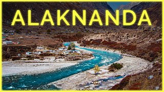
10:32 - 12:19 Alaknanda Basin
12:20 - 14:11 Kali Basin
14:12 - 15:36 Ramganga-Kosi Basin
15:37 - 16:46 Ganga Nayar Basin
-----------------------------------------
CREDITS:
Videos:
Massive thanks to these guys for helping out with a lot of high quality footage, drone shots mainly.
KSR Photography for clips around Chamoli District
/ uk_suraj
Deepak Bafila for almost all of Kumaon's drone shots.
/ himalayan_hawk
Shashank Rawat for almost all of the remaining Garhwal region's drone shots.
/ myflyingguide
Sumit Samantray for drone clips of Gangotri, Rudraprayag and Kedarnath.
/ nature_lust_sumitism
Krishna Dhami for drone clips of Pithoragarh and Kali Basin.
/ chris_productions2.0
Dixit Pathak for the clip of Jadh Ganga Basin.
/ dixit_pathak103
Ronnie Patiyal for drone shots of Nainital.
/ ronnie.patiyal
License: https://creativecommons.org/licenses/...
Drone footage of Nandaprayag and Nandakini by Counting Kilometer
/ countingkilometers
Photos (Creative Commons license):
https://creativecommons.org/licenses/...
Madmaheshwar by Bodhisattwa, CC BY-SA 4.0, via Wikimedia Commons.
Wild Solitude (Corbett Elephant) by Gnishith 95, CC BY-SA 4.0 , via Wikimedia Commons.
Champawat by WhiteRaven335, CC BY-SA 4.0, via Wikimedia Commons.
Bedini Bugyal by Shaswat Nimesh, CC BY-SA 4.0, via Wikimedia Commons.
Gangotri Glacier Phani2, CC BY-SA 4.0, via Wikimedia Commons.
Surkanda Devi Temple by Bhattnitesh29, CC BY-SA 4.0 , via Wikimedia Commons.
Village in Rawain by Anuj19, CC BY-SA 4.0 , via Wikimedia Commons.
Supin Valley by Govind Shirude, CC BY-SA 4.0 , via Wikimedia Commons.
Har Ki Doon valley by Metanish, CC BY-SA 4.0 , via Wikimedia Commons.
Kamet by Rohit Gosain, CC BY-SA 4.0 , via Wikimedia Commons
Way to Kailash by Jean-Marie Hullot, CC BY-SA 4.0, via Wikimedia Commons.
Kailash Mansarovar by Jean-Marie Hullot, CC BY-SA 4.0 , via Wikimedia Commons
---------------
https://creativecommons.org/licenses/...
Gaumukh by Debashish Mahapatra, CC BY-SA 3.0, via Wikimedia Commons.
Yamuna at Yamunotri by Atarax42, CC BY-SA 3.0 , via Wikimedia Commons
---------------
https://creativecommons.org/licenses/...
Harul Dance by Ramesh Lalwani, CC BY 2.0 via Wikimedia Commons.
---------------
https://creativecommons.org/licenses/... use:minor Illustration)
River Tons by Ajay Bhandari
https://www.flickr.com/photos/3019167...


Информация по комментариям в разработке