Part 1 of 2.
Driving Entire Interstate Freeway I-5 South From Canada Border to Mexico Border - 4K
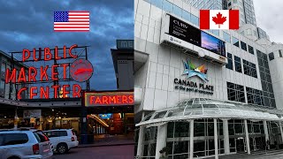
This USA road trip starts in the city of Blaine, Washington State, next to US - Canada border crossing and ends in San Ysidro, California State next to US - Mexico border crossing
This American car journey includes driving through 3 us states: Washington, Oregon and California
Watch part 2 here:
• 2 of 2 Driving Entire Interstate Free...
Interstate 5 (I-5) is the main north–south Interstate Highway on the West Coast of the United States, running largely parallel to the Pacific coast of the contiguous U.S. from Mexico to Canada.
It travels through the states of California, Oregon, and Washington, serving several large cities on the U.S. West Coast, including San Diego, Los Angeles, Sacramento, Portland, and Seattle. It is the only continuous Interstate highway to touch both the Mexican and the Canadian borders.
Upon crossing the Mexican border at its southern terminus, I-5 continues to Tijuana, Baja California, as Mexico Federal Highway 1.
Upon crossing the Canadian border at its northern terminus, it continues to Vancouver as British Columbia Highway 99 (BC 99).
California
I-5 in the Newhall Pass Interchange where it intersects with I-210 and State Route 14 near Santa Clarita
Interstate 5 in California
The southernmost point of I-5 is at the Mexican border at the San Ysidro Port of Entry, one of the busiest border crossings in the world
Oregon
I-5 running adjacent to the Willamette River and passes by the Moda Center, and Oregon Convention Center in Downtown Portland
About three miles (4.8 km) north of the California border, the highway crosses 4,310 feet (1,310 m) Siskiyou Summit, the highest point on I-5, and then drops down into the Rogue Valley through Oregon's southern mountains and towns such as Ashland, Medford and Grants Pass.
Turning north across three passes to the Umpqua Valley and through Roseburg, the mountains tend to turn into hills, and as it reaches Cottage Grove, the road enters the Willamette River Valley.
At Eugene the highway intersects I-105, a short spur route into Downtown Eugene. Some city highways intersect on I-5 in the Eugene Metro.
The Interstate then heads almost due north, skirting Albany and Corvallis, passing through Salem, and crossing through Woodburn.
There were plans to build a spur, called I-305, into Salem. I-5 covers 308 miles (496 km) in Oregon.
Washington
I-5 passing through downtown Seattle
The highway continues over the Columbia River and drops down into the city of Vancouver.
About seven miles (11 km) into the state, it reaches the northern terminus of I-205, which is on the eastern edge of the Portland–Vancouver metropolitan area.
It then tracks north by northwest through Woodland to Kelso and Longview, at which point it ceases to parallel a large bend of the Columbia River.
Continuing north between the Willapa Hills and the Cascade foothills, the freeway eventually reaches Olympia, where it bends sharply east.
The highway passes through the northern end of Joint Base Lewis-McChord (formerly Fort Lewis and McChord Air Force Base) and Tacoma, where it bends sharply north again to reach Seattle.
The Ship Canal Bridge carries it over Portage Bay in Seattle. The freeway continues north out of the Seattle–Tacoma–Everett metro area, crosses the floodplains of three rivers, through the Skagit Valley and the Mount Vernon–Burlington Metropolitan Area to the northern city of Bellingham, to arrive at the Peace Arch Canada–US border crossing between Blaine, Washington, and Surrey, British Columbia. Highway 99 continues northwest from the border into Vancouver, BC. I-5 covers 277 miles (446 km) in Washington.
Interstate 5 (I-5) is a major north–south route of the Interstate Highway System in the United States, stretching from the Mexican border at the San Ysidro crossing to the Canadian border near Blaine, Washington.
From San Ysidro, the segment of I-5 in California runs north across the length of the state, and crosses into Oregon south of the Medford-Ashland metropolitan area.
It is the more important and most-used of the two major north–south routes on the Pacific Coast, the other being U.S. Route 101 (US 101), which is primarily coastal.
Dash Cam Tours
#RoadTrip #Freeway5 #interstate5
Follow on Twitter:
(@SafetyPint): https://twitter.com/SafetyPint?s=09
Dashcamtours.com
Subscribe to my SECOND CHANNEL with walking tours:
/ @povwalks

![[4K] Scenic California Drive. Big Sur. Most scenic driving route in the United States](https://i.ytimg.com/vi/cHTEuEBw_wk/mqdefault.jpg)


Информация по комментариям в разработке