GPX Download Of Route...
https://drive.google.com/file/d/1M_PL...
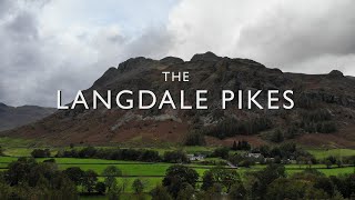
Among the best-known features of Great Langdale are the Langdale Pikes, a group of peaks on the northern side of the dale. From below, they appear as a sharp rocky ridge, though they are precipitous only on their southern side; to the north, the land sweeps gently to High Raise, the parent peak of the range. The Pikes themselves include (from west to east) Pike of Stickle, Loft Crag, Harrison Stickle, and Pavey Ark.
Pavey Ark is 700 metres (2,297 feet) high. The main face is a little over 1⁄4 mile (400 metres) across and drops about 400 feet (120 metres). To the southwest, it merges into the crags of Harrison Stickle, while the northern end peters out into the valley of Bright Beck. Stickle Tarn is wholly within the territory of the Ark, a corrie tarn which has been dammed to create additional capacity. The stone-faced barrage is low enough not to spoil the character of the pool, and the water is used for public consumption in the hotels and homes below. The tarn has a depth of around 50 feet (15 metres).
Harrison Stickle is the high point of the Langdale Pikes and its crags fall south and east from the summit, presenting an arresting view from the valley floor 2,000 feet (610 metres) below, or from further afield. To the north, the main ridge of the central fells passes over Thunacar Knott before climbing to High Raise. The craggy eastern face of this ridge continues north as far as Harrison's near neighbour, Pavey Ark, visually the most impressive face in the area. The southwestern border of Harrison Stickle is formed by the deep ravine of Dungeon Ghyll, which cuts through the parapet of the Langdale Pikes and into the lower hinterland of Harrison Combe. Across the Ghyll westwards are Thorn Crag, Loft Crag, and finally Pike of Stickle. Below the steep eastern face of Harrison Stickle lie Stickle Tarn and its Ghyll, thus ensuring that all drainage from the fell is to Great Langdale.
Pike of Stickle, also known as Pike o’ Stickle, reaches a height of 709 metres (2,326 ft). The rearward slopes show evidence of the Pavey Ark Member, pebbly sandstone and breccia. The Langdale face displays several strata: from the top the Lingmell Formation, Crinkle Member and Bad Step Tuff. These are composed, respectively, of tuff, lapilli-tuff and breccia; rhyolitic tuff and breccia; and rhyolitic lava-like tuff.The altitude places Loft Crag and Gimmer Crag within sightlines to east-southeast while
Bowfell is three kilometres (two miles) west-southwest. The Southern Fells and Skiddaw are also potentially visible.
Loft Crag has a summit elevation of 2,238 feet (682 metres). It lies between Harrison Stickle and Pike o’ Stickle and is usually climbed in conjunction with these two peaks. The fell has a small sharp summit, below which rises Gimmer Crag, which is one of the top rock climbing venues in the Lake District. The crag is made of Rhyolite rock and was pioneered in the early 1880s by the father of British rock climbing Walter Parry Haskett Smith.
#pikeofstickle #harrisonstickle #loftcrag #mountains #mountain #rivers #hills #hillwalking #fellwalking #waterfall #lakedistrict #cumbria #lakedistrictnationalpark #nature #hiking #getoutside #wainwrights #birketts #hewitts #marilyns #wellbeing #alfredwainwright #billbirkett #liveyourbestlife #mentalhealthmatters


Информация по комментариям в разработке