ACCESS OUR BRAND-NEW GEOGRAPHY SCHEME HERE:
https://grammarsaurus.co.uk/portal/ge...
Transcript:-
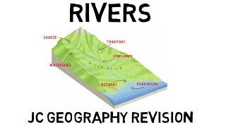
The course of a river is the path that it takes. A river has three courses – the upper, middle and lower course.
The source of a river is often in upland areas such as mountains. At this point, high levels of rain and snow, combined with steep slopes, lead to water flowing downhill.
At this stage, the streams are small and narrow and there is less water than other parts of the river’s journey. Because of this, water flows very quickly. It moves rapidly through a narrow channel of rocky hills or mountains, where it can wear away rock to create waterfalls and valleys.
Tributaries are also formed in the upper course of a river. These are small rivers or streams that join to the main river. The more tributaries that join the river, the more powerful the speed of the river becomes as it travels. The place where the tributary and the main river meet is called a confluence.
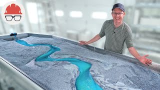
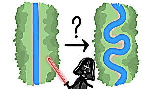
As the land becomes flatter, the river moves into its middle course. In the middle course, the river is wider and deeper. There is more water, and it does not flow as quickly. Instead, it begins to twist and turn, creating loops, curves or meanders. At this stage, the shape of the river is constantly changing due to erosion.
On its journey from the middle to the lower course, the river’s meanders become more noticeable. Rivers make extreme loops. Eventually, with continued erosion, these loops join together.
Finally, the river will take a straighter, more efficient course, cutting off the meander altogether. When this happens, an oxbow lake is formed, creating a separate, free-standing body of water while the river continues its new channel. Eventually, the oxbow lake will dry up.
As the river has now straightened, it is entering the lower course stage. When the river reaches the lower ground, it begins to widen, slow down and flatten out. This usually happens when it reaches an ocean, lake or wetland.
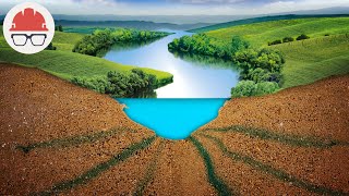
In the lower course, the river has a wide floodplain. This is a flat area of land around a river that is covered in times of flood. A floodplain is a very fertile area which makes them a good place for agriculture. Every time a river floods its banks, it will deposit more silt or alluvium on the floodplain. A build-up of alluvium on the banks of a river can create levees, which raise the riverbank.
An estuary is where a river meets the sea. There, salt water mixes with fresh water to become what is known as brackish water. The river becomes wider and wider and flows slowly to the ocean or sea.
Rivers often carry a lot of soil, sand, and other material. When the momentum of a river slows at its mouth, some of that material settles. Over the years, this material builds up to form a delta. The surface of a delta is almost level and the river usually flows across it in several small branches.
At the end of its course, a river enters the sea.


Информация по комментариям в разработке