Located in the county of Kent, and around 60 miles east of Greater London, is the town of Ramsgate.
The name 'Ramsgate' is derived from Old English for 'raven's cliff gap'. Its known history dates back to circa 597 AD when the prior of a Roman monastery, known as Augustine, landed here. He was sent by Pope Gregory the Great with the aim of Christianising King Æthelberht of Kent, in what became known as the Gregorian Mission. After converting the king and many of his subjects, Augustine became the first Archbishop of Canterbury in circa 603 AD.
Until around the 17th century, Ramsgate was part of an island that was separated from the British mainland by the Wantsum Channel, known as the Isle of Thanet. Eventually the channel silted up, and the last known instance of a ship traversing it was in 1672. The name 'Thanet' is still used for ceremonial purposes in reference to the geographical area of northeastern Kent in which it lies.
For several centuries, Ramsgate was a tiny fishing and farming hamlet. This began to change from around 1749 with the beginning of the construction of a harbour. This was ordered as the result of a violent storm that had occurred the year before. During the Napoleonic Wars, British troops were quartered here before embarking for the continent.
In 1821 King George IV set off for Hanover via Ramsgate. The story goes that he was so impressed by the hospitality he received that he decreed it a Royal Harbour, making it the only one in mainland Britain with this claim. The following year, an obelisk was placed outside the Clock House (built 1817, now home to Ramsgate Maritime Museum). The obelisk commemorates George IV's royal visit.
In addition to its harbour, Ramsgate grew as a result of the rise in popularity of seaside towns. Many visited for the health benefits of 'taking the waters'. Famous 19th century visitors include Queen Victoria (or Princess Victoria as she was at the time), Jane Austen and Samuel Taylor Coleridge. Also, Charles Dickens had a summer residence in the neighbouring town of Broadstairs around two miles away.
In 1876 a young Vincent van Gogh came to Ramsgate as a teacher at a boys' boarding school. He was given accommodation on Spencer Square, and taught across the way at Royal Road, both of which feature in the walk from around the 15-minute mark. Van Gogh's tenure at Ramsgate lasted for two months, after which point he left for Isleworth, along with the proprietor.
Ramsgate's first railway station opened in 1846. This would eventually close in 1926, at which point it was replaced by the current station. Today it is one of the two eastern termini on the Chatham Main Line, with the other being Dover Priory owing to a junction at Faversham. Trains to central London typically take around two hours, although high speed services can reach St Pancras station in around 75 minutes.
In 1901 an electric tram service opened, serving the towns of Ramsgate, Broadstairs and Margate, making it one of the first inter-urban tramways in Britain. Another unique transport service opened in 1969 with a hovercraft to Calais. This ceased operation in 1982. From 1998 until 2013, Ramsgate was a ferry port, courtesy of Transeuropa Ferries which provided a link to Ostend in Belgium, up until the company's demise due to bankruptcy.
Shortly before the start of the Second World War, a network of deep shelter tunnels were built in Ramsgate, with room for over 60,000 people. In 2014 these opened to the public as a volunteer-led heritage attraction. In 1940 Ramsgate played a key role in the Dunkirk Evacuation, a.k.a. Operation Dynamo. On the 24th of May, around 4,200 ships left Ramsgate Harbour to rescue Allied soldiers from the beaches at Dunkirk. Around 82,000 men were brought back here in various small vessels before being transported west via special train services.
👇 SUBSCRIBE TO 4K EXPLORER FOR NEW VIDEOS EVERY WEEK 👇
https://www.youtube.com/4KExplorer?su...
Filmed: 12th February 2023
Link to the walk on Google Maps: https://goo.gl/maps/2QGsVmvJAM74sMz87 (minus the walk to the beach at the end as I ran out of plotting points on Google Maps!)
Filmed on a Sony FDR-AX700 with a Zhiyun Crane 2 and a Sony ECM-XYST1M Stereo Microphone.
TIMESTAMPS:
0:00 St George's Church
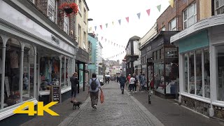
0:06 High Street
3:41 Harbour Street
5:29 Harbour Parade
6:28 Royal Parade
7:01 Leopold Street
7:27 West Cliff Arcade
9:06 Sion Hill
10:23 Prospect Terrace
11:07 Nelson Crescent
12:35 Paragon
14:50 Royal Road
15:46 Spencer Square
17:54 Paragon
21:09 Jacob's Ladder
22:12 Sailors' Church
22:18 Military Road
23:32 West Crosswall
25:34 East Crosswall
30:11 East Pier
30:59 Harbour Parade
31:42 King Edward VIII Postbox
31:55 Harbour Parade
34:41 Madeira Walk
37:07 Wellington Crescent
39:45 Marina Road
40:12 Augusta Steps
41:22 Marina Esplanade
41:47 Ramsgate Beach


Информация по комментариям в разработке