At least once a month we try to return to our ongoing "River Run" series, in which we've been making our way down the Mississippi River -- and in this, our seventeenth episode of this particular trip, we're inching ever closer to the Gulf Coast. However, just west of the mouth of the mighty river, an even mightier force of nature was wreaking havoc on Texas and the surrounding area. Tropical Storm Beryl, recently downgraded from hurricane status, was fortunately not having a direct impact on our itinerary -- we were just east of a significant stray band of heavy precipitation, but the high and gusty winds emanating out from it were the real story for tonight's stream.
We resumed our trip from Natchez-Adams County (KHEZ) headed northwest toward Summerell (1LS8), listed as a pair of parallel runways with one paved and one turf. Right from the outset, though, we realized that the biggest impediment to identifying our destination from the sky was the low layer of haze! We struggled to keep VFR-legal -- and by the time we figured out where we were, we realized we were about two miles north of where we had intended to be. The strong gusty winds, mostly out of the south, were a factor in our evening already. Once we compensated, though, we found our farm right up against another "oxbow lake" (as they call those orphaned loops of the river), and entered a tight downwind to a reasonably smooth arrival on the long, narrow driveway.
Seven miles south was Concordia (0R4), a Parish airstrip (which, in Louisiana, is similar to what we'd elsewhere call a "County" airstrip) which offered a 3,700-foot paved surface. Visibility was still questionable but we found it without too much difficulty. Even though the scenery rendered the runway with the telltale yellow "X" marks indicating it was closed, we operated under the reasonable assumption that it had probably re-opened not long after the Bing imagery was taken, so we landed anyway. Our flare was poorly timed with the gusts and overdone -- but the second attempt of the roundout and flare worked much better and we were down once again, nice and gently.
Our next stop was the private strip called Braughton (LA40), another one which listed both a paved and grass strip. As we picked up the river and headed south, the hazy layer finally lifted and our visibility improved significantly although the gusty wind persisted. We found a number of suspiciously airstrippy candidates, but, finally found one cut into a rectangular clearing out of a patch of woods which appeared to be our destination. The closer we got, the more sure we were. It was another one where my flare took us back skyward and we had to re-adjust -- then even the landing caused a skim and a skip that sent us airborne again. With plenty of grass left in front of us I simply adjusted power and made the third time count.
Another 23 miles south led us to Angola (LA67) -- which we noted was right next to a penitentiary and a lake -- and figured those two facts would make it easy to locate. We did easily find the lake and the prison, but after a few circles it was less than obvious what the actual runway was supposed to be. The only candidates we found were aligned improperly to the directory's notation of being a north-south runway. So we gave up on that and moved on to False River (KHZR) which we figured would be obvious given its status as a 5,000-ft paved municipal strip. We were correct, but the gusty winds got worse and worse on final, and we fought with those gusts for probably three-quarters of the strip's lengths. It was ugly, but "I figured floating was better than crashing," as I said in the narration.
With Omni (LA46) resting within the lateral boundaries of the Baton Rouge Charlie, and Houston Center online to provide ATC services, we figured that after departing from False River it was more prudent to check in for flight following than it was to try to sneak into Omni below the 1,300-foot outer Charlie shelf. The controller was happy to get us ID'd and figure out our plans, and we found Profit Island and worked our way down to the 3,500-foot grass strip from there. Fortunately the curves and bends of the river made the airport easy to locate, cut as it was right out of the side of a wooded grove. Yet we were once again saved by how long it was, allowing us extra room to stabilize our approach in the shifting winds.
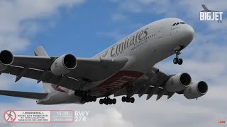
The final trip took us to Baton Rouge (KBTR) at the center of the aforementioned Charlie, and we followed a friend in for a right downwind to Runway 22R. With 7,500 feet of pavement to work with this time, we had no qualms about taking a good chunk of it to track down the centerline and ensure we were nice and stable against the unpredictable winds. We used all the width and length we had, set it down slightly sideways, and yet lived to tell the tale! -- Watch live at / slantalphaadventures


![[ MSFS2020 | VATSIM ]](https://i.ytimg.com/vi/JxcagZRPUIw/mqdefault.jpg)


Информация по комментариям в разработке